Day 18: 4th State!

Las Cruces, NM to Horizon City, TX
Date: 01/19/2013
Distance traveled: 69.75 miles (995.19 miles total)
GPS tracks: http://connect.garmin.com/activity/263868849


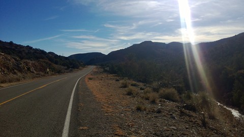
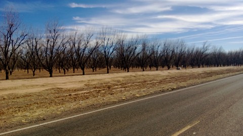
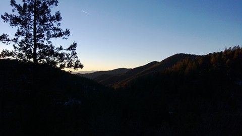
Mountains and trees – the scenic ride into El Paso.

[Aside: Thank you all for the comments and the encouragement. Please keep them coming. :) ]

After a lot of humming and hawing, I finally decided to stick close to the Adventure Cycling Association’s route rather than diverge a bit… I had been thinking that it would be nice to see more parks before heading into West Texas. I was looking at going up to Hueco Tanks State park, and then over to the Guadalupe National Forrest. But time and distance changed my mind.

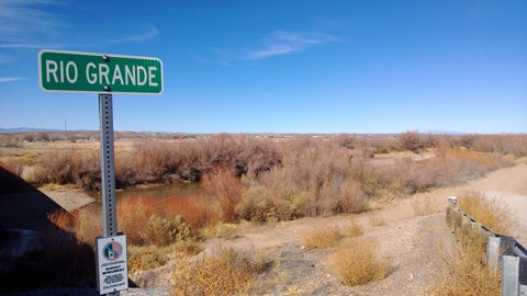
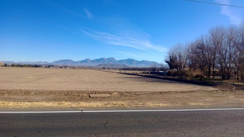
So I set out this morning on highway 28 and unceremonially crossed into Texas. There was no sign. No marking of any kind. I kinda feel cheated. But all of a sudden, bam, you’re in Texas and you didn’t even know it.


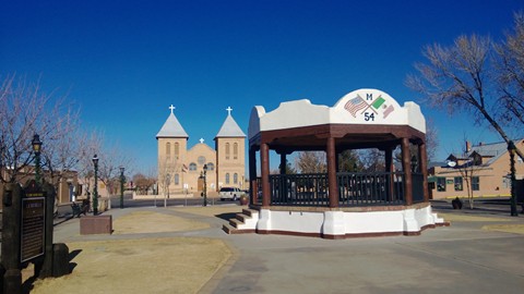
Mesilla is a cute little town just outside Las Cruces.

I had intended to avoid El Paso entirely rather than ride straight through it. There’s a nice route that takes you over and around the city (through the Anthony gap). I hate city biking so I thought this looked like a great plan. If only I hadn’t missed my turn!

I didn’t set up the Garmin – I was just going to look for the road sign instead. But I got distracted. Highway 28 is a well known bike route and there were A LOT of bikes out. I counted 50 cyclists total before I lost count. I even ended up riding with a woman who was training for a half Iron Man for 25 or so miles. My average speed was about 5mph faster when I was riding/racing with her than normal. It made for a fast and enjoyable morning.

So I missed my turn off while I was racing along. Biking through El Paso sucked. The roads/sidewalks nearly knocked my teeth loose. Glad to be passed that.

My end point tonight was with another awesome warm showers host. They live in Horizon City, TX. Horizon City, TX is (not surprisingly given the name) uphill from the route. 5 miles out of the way, but worth it!

Dan and Dawn are great hosts. You’ve got to love dogs to stay here! She owns a Great Dane rescue and has 5 adorable and well behaved great danes in the house, with Benji the terrier to keep them all in line. I really enjoyed dinner and playing with the dogs. Lots of sad rescue stories about the puppies. You just wouldn’t believe the condition of some of these dogs when they come in. It’s sad to see what folks will do to these poor dogs.


Tyranny was my favorite dog. You should see her pics from when she was rescued. Be warned, they are pretty graphic.


Dawn and the doggies.

Day 17: Gravity is Not Magic

Kingston, NM to Las Cruces, NM
Date: 01/18/2013
Distance traveled: 88.34 miles (925.44 miles total)
GPS tracks: http://connect.garmin.com/activity/263868705


Heading out of Kingston on the big downhill.

After a wonderful dinner, a soak in the hot tub, and a great night of sleep I was actually quite ready to get on the road. The Black Range Lodge was a good pick. Tom made a great breakfast and I enjoyed my time I spent with the owners and other guests. The room was also pretty nice – it evenncame complete with a very handy drying rack.


I normally have to jury rig a drying rack. This tree made it really nice.

I got a pretty early start since the weather is starting to warm up, which is a good thing since I had a lot of miles to cover. The most memorable thing about this ride was that it was moderately difficult. It wasn’t hard, wasn’t easy… just right. I had expected it to be super easy given the elevation that I was going to drop. It turns out that gravity is not that magical. It’s still work to bike 88 miles, no matter how much downhill there is. And there is always an uphill… even on the downhill.


Hatch “chile” sales.

The ride was pleasant and mostly uneventful. Got chased by two scary dogs. I had lunch on the banks of the Rio Grande, which isn’t much of a river right now. I also went through Hatch, NM which is where the famous “Hatch Chili Peppers” are from. This area is covered with cotton, chili, and pecan farms. There are a lot of chili processing businesses along this route.


Not exactly grand.

I also ran out of water somewhat unexpectedly, so I was really ready for some H2O when I got to the next town. That town happened to be Radium Springs which I hear is where some of the radioactive elements for the atom bomb were mined. Also, apparently folks used to soak in radioactive springs out here… that all may just be hearsay, though. The well water I got at the bar didn’t taste so good… with any luck, however, I’ll gain some super powers from drinking it.


This is a bus-stop bench in the middle of nowhere. The sign reads “Bus Stop. San Fe Trailways”.

My day ended in Las Cruces, NM at the lovely home of Mary Beth. We had a nice dinner out and then I came back and quickly crashed – I was exhausted! MB was a great host. I was so thankful for having yet another wonderful place to stay.


One of many pecan farms.


Pretty cute road runner painted on a bridge.


A lot of these towns have tiny, tiny post offices. However, none of them are the smallest in America.


I had no idea my tortillas needed instruction! ;-)


Day 16: Everything I’ve Got

Silver City, NM to Kingston, NM
Date: 01/17/2013
Distance traveled: 48.82 miles (837.1 miles total)
GPS tracks: http://connect.garmin.com/activity/263198071


The view from 8,200 feet at Emory Pass.

I had to give today’s ride everything I’ve got. There was no gas left in the tank once I got to the top of the climb. Zilch. I don’t remember the last time I was so exhausted or had to push myself so hard.

I can’t really tell you why, either – by spec, it was an easier day in terms of elevation gain than the previous ‘hardest’ day, which was Day 2. And it was easier in distance than the longest day, Day 4. So what made this so hard today!?

It could be a number of factors:

  • I skipped my normal lunch of peanut butter, honey & tortilla. Instead, I had a lot of sugar in the form of various gu’s, blocks, gummy bears. I did have an apple, some beef jerky, and a ThinkThin bar in there as well… but it wasn’t really that substantial.
  • This ride came on the heels of two hard rides – one 74 mi ride with moderate elevation gain, and then another 45 mi ride with some considerable elevation gain.
  • I started at and went through much higher elevation today than on any other day – this is the highest point on the ride.
  • It was much colder on today’s ride than on any of the other ‘hard’ rides.
  • Despite the elevation gain, I rode pretty fast today on average.
  • There was a 15-20 mph headwind for the first 10-15 miles that really pissed me off. I’ve never been that mad at mother nature. That headwind did eventually die down as the ride progressed.

I’ll probably never know… but today is now the king of the hard bike rides of my life… or at least this trip.

For the curious, here are the top 4 hard rides on this trip thus far as judged by how I felt about them while doing them and after I was done. Very scientific, I know.

Top 4 Hard Rides thus far… Day Distance (m) Avg. Speed (mph) Elevation Gain (ft) Max. Elevation (ft)
1 (Hardest) Day 16 – Silver City, NM to Kingston, NM 48.82 6.7 5,322 8,221
2 Day 2 – El Cajon, CA to Bankhead Springs, CA 55.87 5.4 6,223 4,122
3 Day 15 – Lordsburg, NM to Silver City, NM 45.38 7.2 3,884 6,348
4 Day 4 – Brawley, CA to Blythe, CA 92.27 9.5 1,601 1,108


Today may have been one of the nicest and prettiest rides, too. I was in the Gila National Forest for the majority of the ride which was really beautiful, even this time of year. Lots of green trees. I miss those!

And the view from the Emory Pass vista was spectacular at sunset… I don’t think the camera quite did today justice.

I’m spending the evening at the Black Range Lodge which is this cool, old lodge that was built in the late 1800’s and been operating as a lodge since the depression. A group of geology students from the University of Wisconsin-Eau Claire have taken over the main lodge. I’m out in the studio which is nice and private. The bonus is that I got free dinner provided by the UofW. J Lucky me – free (and excellent) spaghetti!


The ‘kneeling nun’ – it’s the tiny rock formation near the center of the pic.


Open pit copper mine. There are a lot of open it pit mines out here that are just ugly scars on the land.


Trees! The kneeling nun is there far in the distance.


The roads were a bit icy in spots. This was more trouble on the downhill bomber run than the slow slog uphill.


Nice empty roads. A little cold in the shade, though.


Getting close to the top! Looking back on where I’ve come from today.


Top of the world! I actually changed into dry clothes up here so I wouldn’t freeze on the 10 mile decent! It was cold up there.


Kingston, NM – my destination – is hidden behind that peak.


Me.