Phoenix, AZ to Superior, AZ
Date: 01/11/2013
Distance traveled: 72.04 miles (563.22 miles total)
GPS tracks: http://connect.garmin.com/activity/261057815
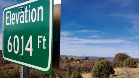
It’s cold. Like, really cold. I suppose I knew there was a risk of it being very cold on this trip, but there was part of me that didn’t believe just how cold it can get. As I write this at 8am in Superior, AZ it is 29° F. I’m heading toward Globe, AZ where it’s even colder (higher elevation). It’s going to be 33° there for most of the day. So, yah… it’s cold. So very happy I’m not tent camping in this weather.
I had dreams of the sunny southwest. For the most part that has delivered – I’ve only had one gloomy day out of the week and a half that I’ve been here. That’s much better than Seattle on average in the winter. But I’m not sure I’m willing to pay for it with respect to the cold. I will say that the averages have been unseasonably cold here – it is normally about 10° F warmer.
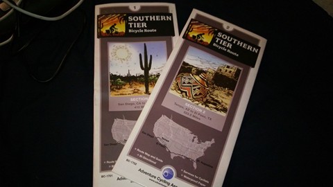
I had to change my plans due to the weather. First off, I’m not willing to camp when the lows overnight get into the mid-20’s – so I’ll be doing more hotels over the next week. The Adventure Cycling Association’s route takes you farther north and to higher elevation than is practical for the weather. I intended to go up to Silver City, NM and through Emory Pass. While I’m still thinking about heading that way, it likely won’t be happening now. That has me a little bummed. That way is supposed to be some of the more scenic parts of the trip, but also some of the most challenging. My alternative is to right a lot more flat and boring highway that doesn’t have me excited at all.
The ride yesterday was fine. Getting out of Phoenix took for-e-ver. I stopped to do some grocery shopping in the morning which put me on the way late. (Side note: I normally take my bike in places when I shop, eat, etc. To avoid the hassle/worry of locking it up and taking all the bags inside. No place has had a problem with it until yesterday where I got hassled by the Safeway manager. Something about tearing up her store. Meh.)
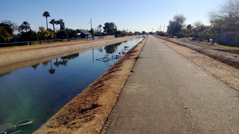
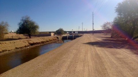
The nice part about riding out of Phoenix was the canals. I plotted a route with the help of Cary that took me along several long stretches of canal. The conditions along them were variable from sweetly groomed cement to glass-shard studded asphalt to dirt path. But it was fast, and nice not to have to deal with traffic for about 20 miles of the trip!
In Phoenix, this was pretty typical. I hear they clean out the carts once a year. Lots of glass & graffiti.
Nicely packed earth to ride on through the more industrial sections as you get close to Tempe.
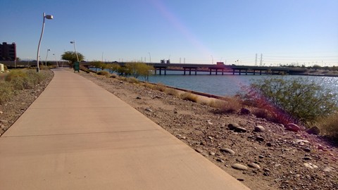
Riding around the lake near Tempe
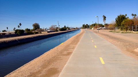
Mesa gets the award for the nicest bike paths.
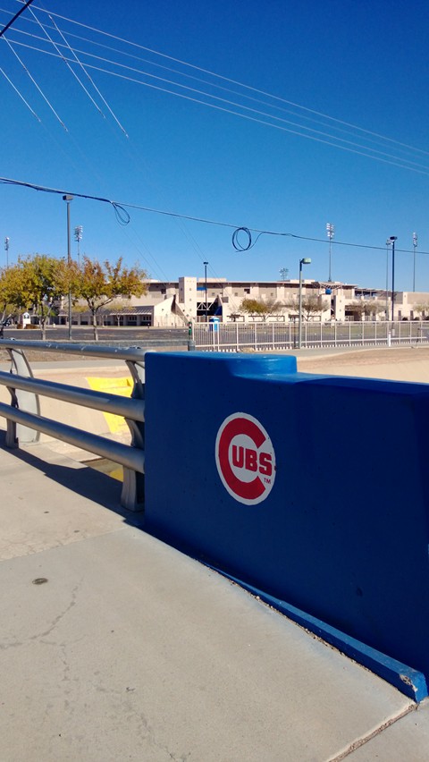
Cubs spring training facility.
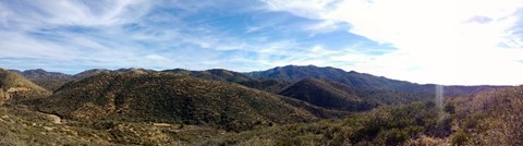
Eventually I did make it out of the city after about 30 miles of riding – the rest of the ride was typical desert riding to Superior. The climb at the day wore me out. I think it’s nearly time for another rest day.
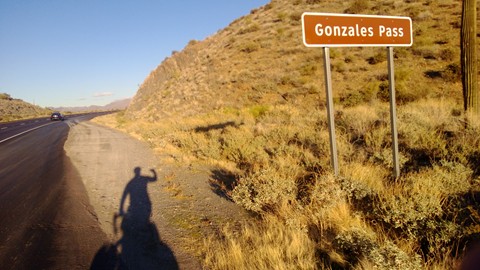
It wasn’t that bad of climb, but it felt like it.
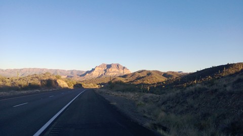
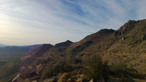
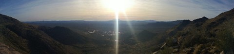
Looking down into the valley where Superior awaits.
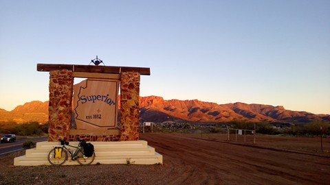
Finally!
When I arrived at my warm showers host one of their neighbors was outside looking through his makeshift half-binocular sighting scope. Thinking it might be my host I asked what he was looking at. Dude was insane. He was telling me about all the pictures he can see in the face of the rocks that the ancients have left here for us to see. How the same things he can see in the face of the rock cliffs, he can see in various smaller rocks. How he can see the same pictures and patterns on the moon as he can see down here. He showed me pictures on his camera. He went in his house and brought out rocks for me to see. It was sorta like looking at clouds… most of the time I could make out the shapes he was telling me they were, but most of the time they just looked like swirling patterns in the rocks. Cray cray.
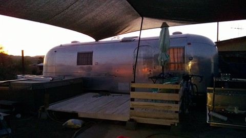
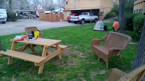
My oasis.
Charles and Mari are great hosts. They have this awesome old airstream trailer setup in their back yard for guests. It was nice to have some privacy for the night. They weren’t here when I got here, but I was instructed to make myself at home. So I did. I got showered up, sat in the awesome hot tub, showered again, and did some laundry before they got home. Charles and I spent a few hours chatting before they had to take off to their dinner plans. I spent the night eating out of their well-stocked fridge and watching movies on my Surface… I was so very tired. I was happy to get to sleep under that electric blanket.
Today I’m going to do short miles – only about 25 to Globe, AZ. I think I need a shorter day on the bike today in lieu of taking an entire day off.