9/25 Update: I’ve added Allen & Ian’s photo’s to my Picasa album.
The Wallowa Mountains are apparently one of the Pacific North West’s best kept secrets. The trails are listed in the standard Oregon backpacking guide books, but everyone I’ve talked to has never heard of them despite being some hiker’s all-time favorite treks. It’s a tough comparison, but I think this hike might just replace the hike I did last summer in the Olympic National Park as my all time favorite trip. It definitely was the hardest and most rewarding hike I’ve been on yet.
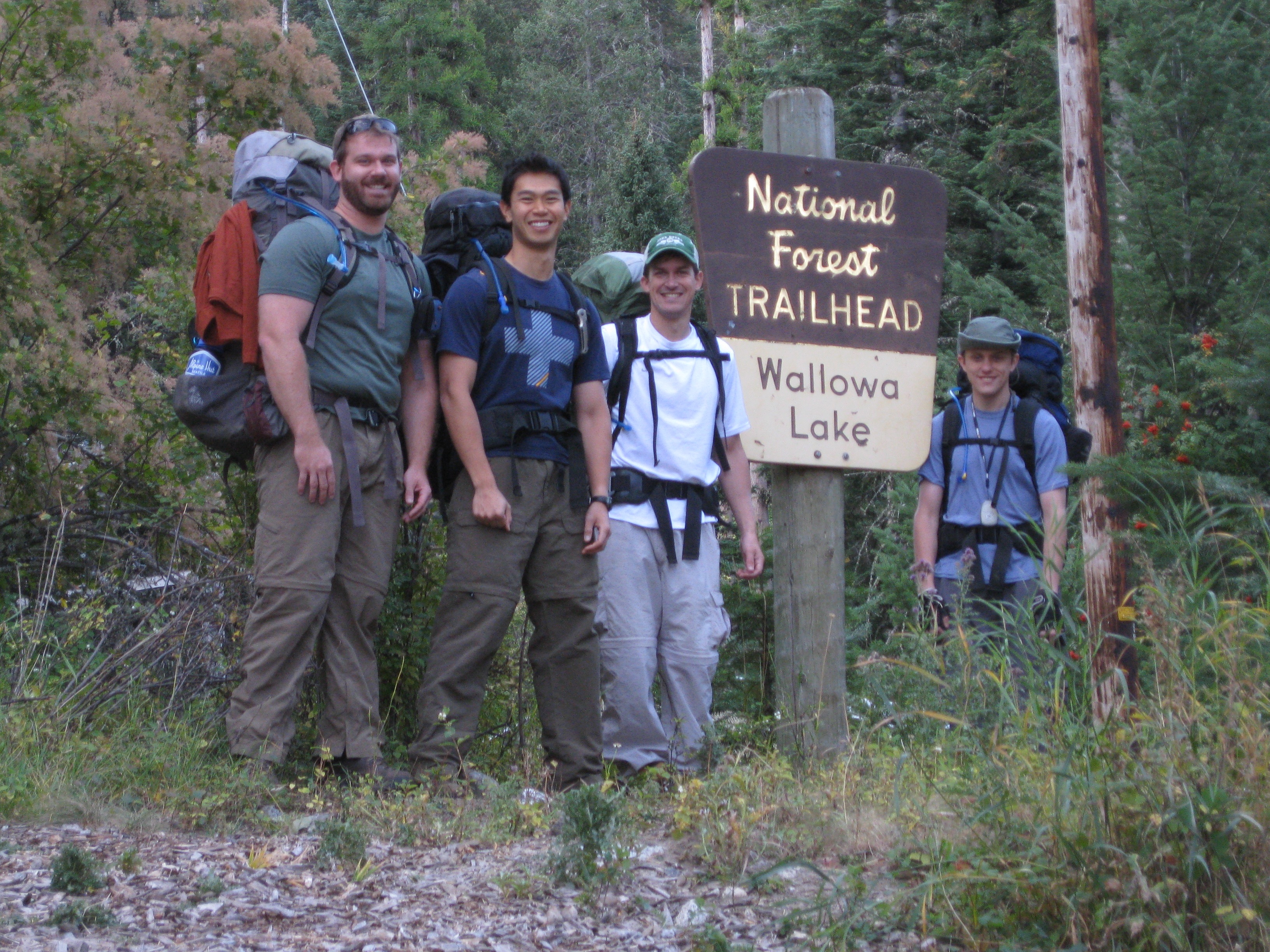
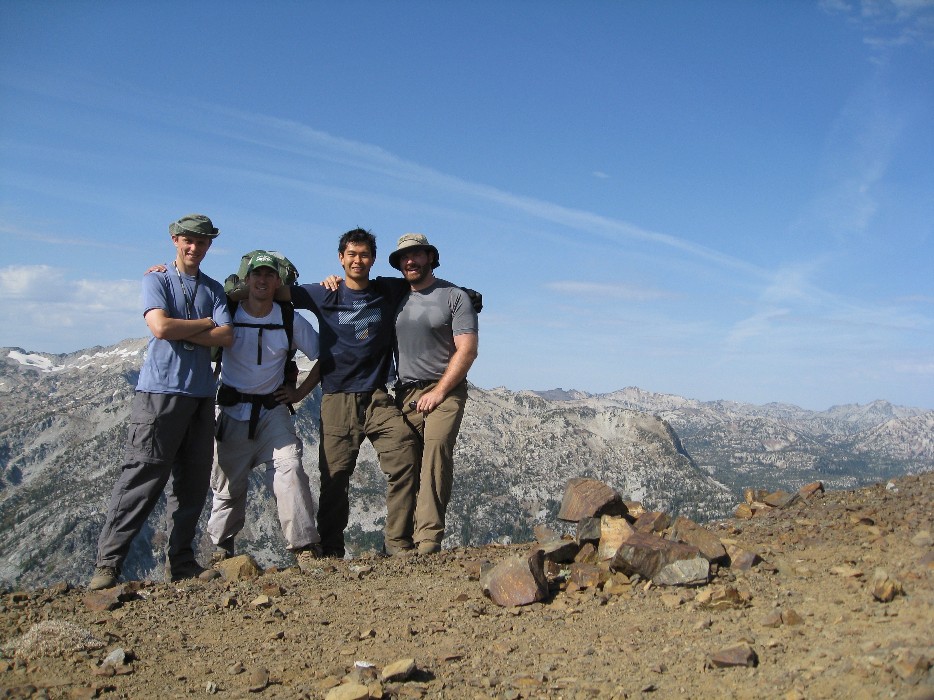
Ian, Steve, Allen & I set out on our 36 mile hike through the fantastic Lakes Basin of the Wallowa Mountains on Thursday morning. Our intent was to be out for a total of four days, traveling around 6-10 miles a day. We ended up doing the whole thing in three days because the weather got pretty crappy on the second night and kept on being nasty through the third day. Despite that, it was still a beautiful trip.
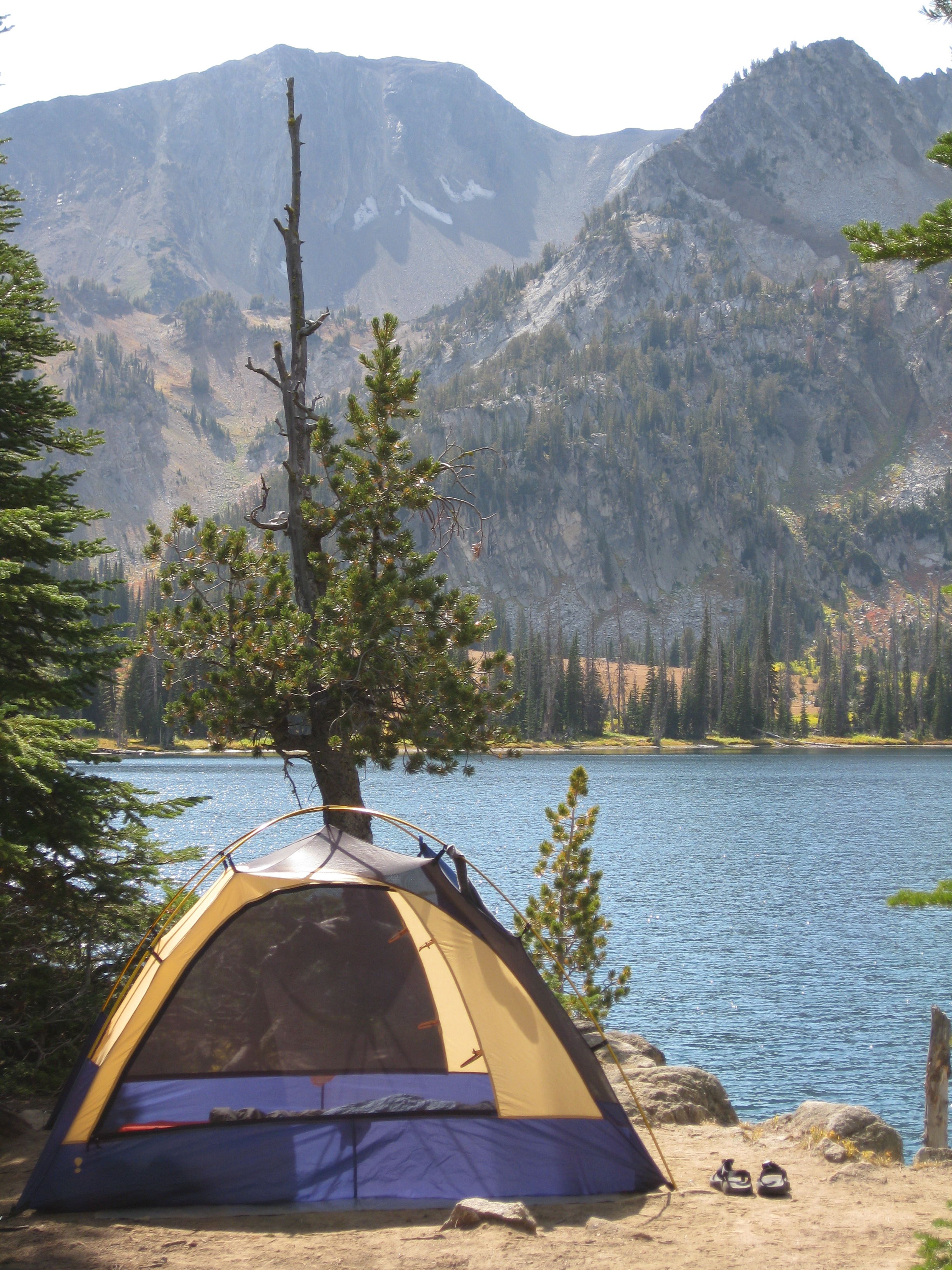
Day 1: On our first day we set out from the Wallowa Lake trailhead toward our campground at Aneroid Lake. It was a relaxing 6.3 miles covering around 3200 feet of positive elevation. The trails were nice, it was a beautiful day, and we made it to camp right at lunch time. Perfect. After fueling up, we explored a bit and hiked around the lake. Steve and I were brave enough to take a swim in the frigid Aneroid Lake. It was so cold that I (quite literally) could not breath when the water hit my chest. Talk about refreshing!
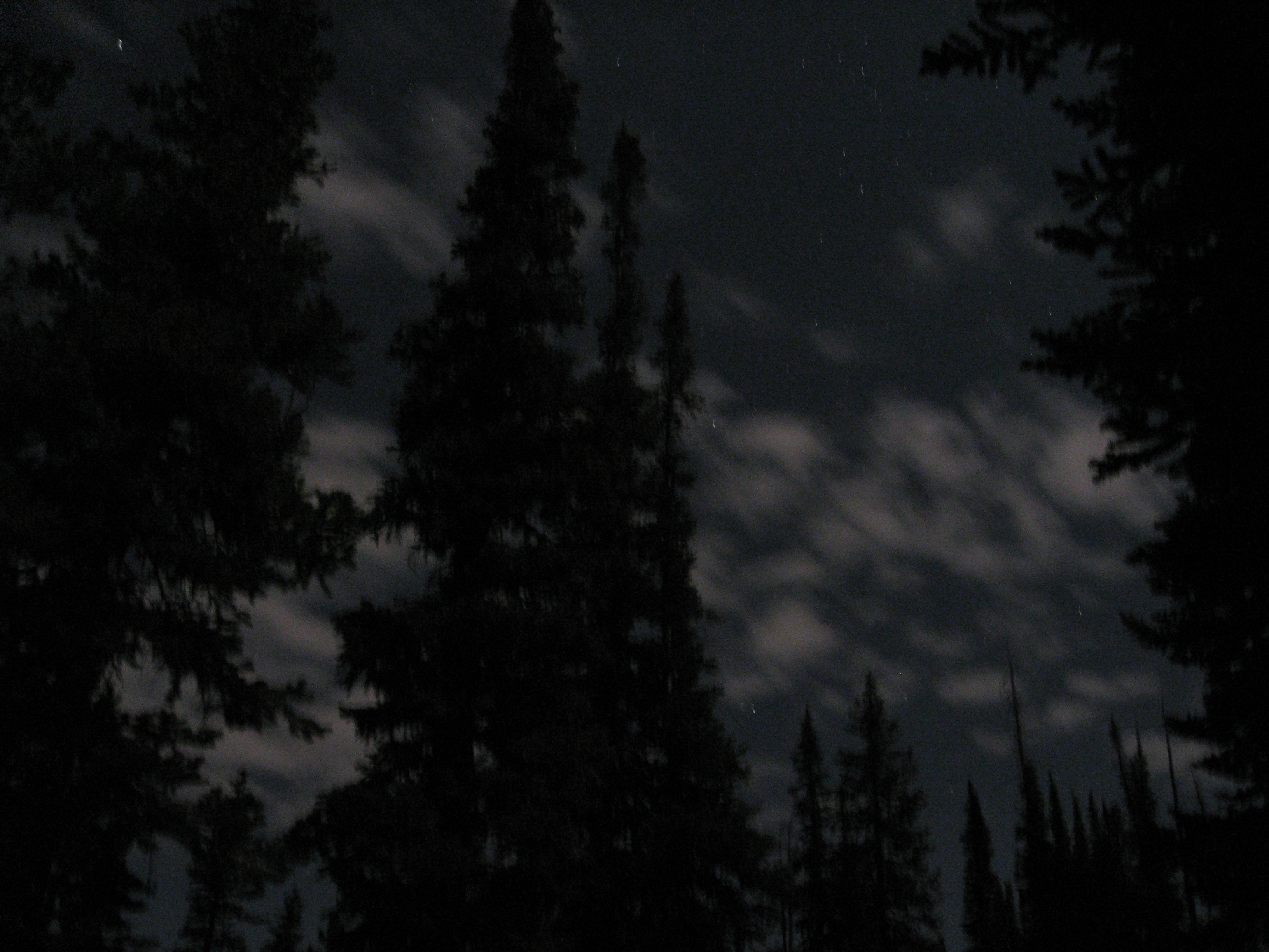
The night was gorgeous, with a wonderful full moon and packed with stars making the view from my tent sans rain-fly superb. It made not being able to sleep well worth it.
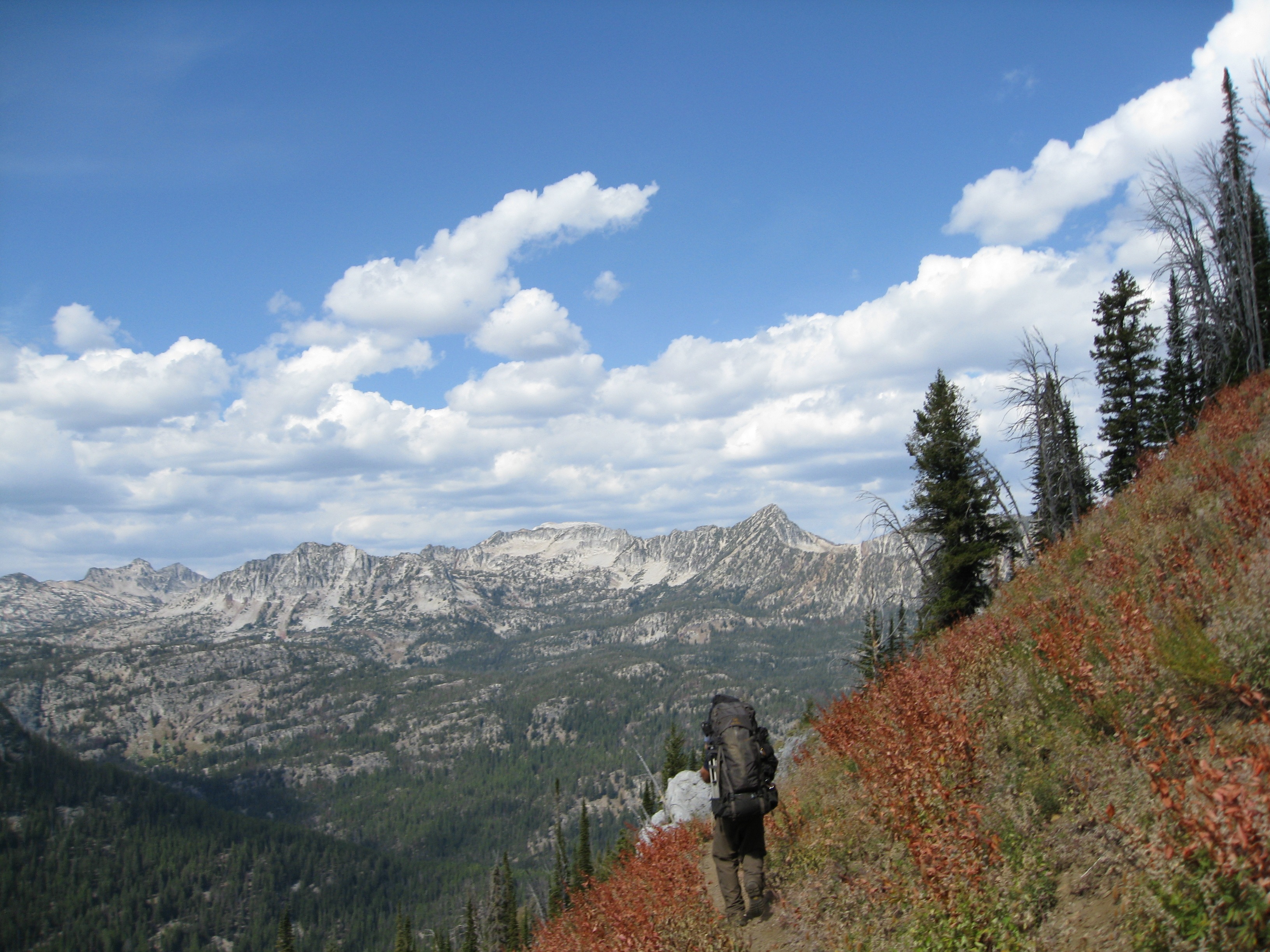
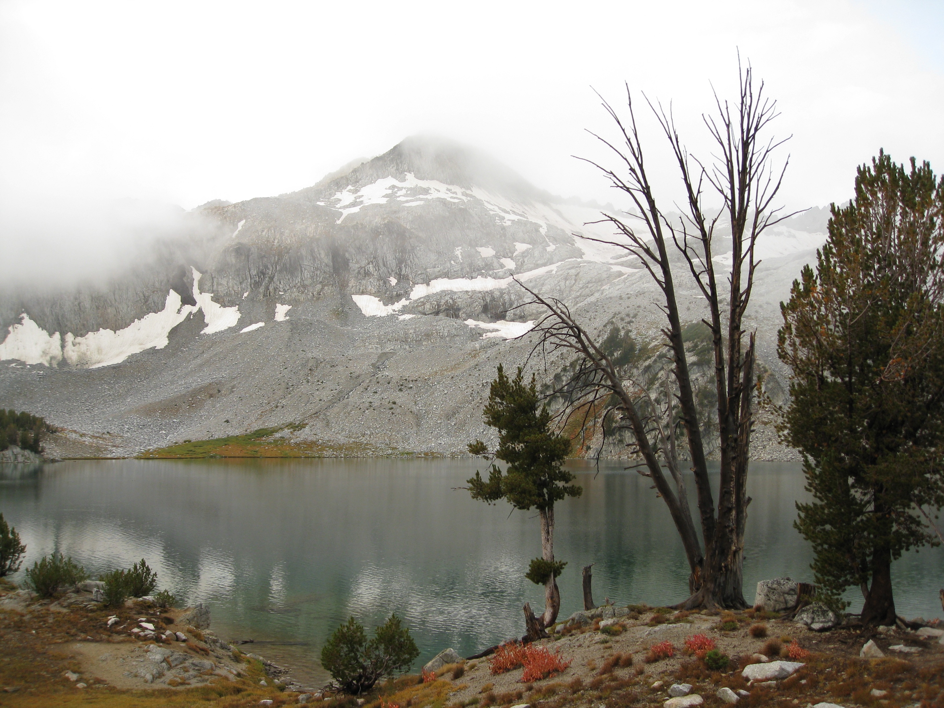
Day 2: The plan on the second day was to cover the 11.9 miles from Aneroid Lake to Frazier Lake over Polaris Pass at 8800 feet, the highest point in our trip. We covered a pretty decent amount of up and down, going up a total of around 2200 feet over the course of the day. The view from the top of the pass was amazing. The hiking was definitely tougher on the second day for me. The hardest part of the hike was making our way down the scree at the top of the pass; it was precarious at best. But the flowers and the fields that we passed through made it a beautiful day. We got in, set up camp, and had a trail-sauce enhanced meal that wrapped up just as the first rain drops started to fall…
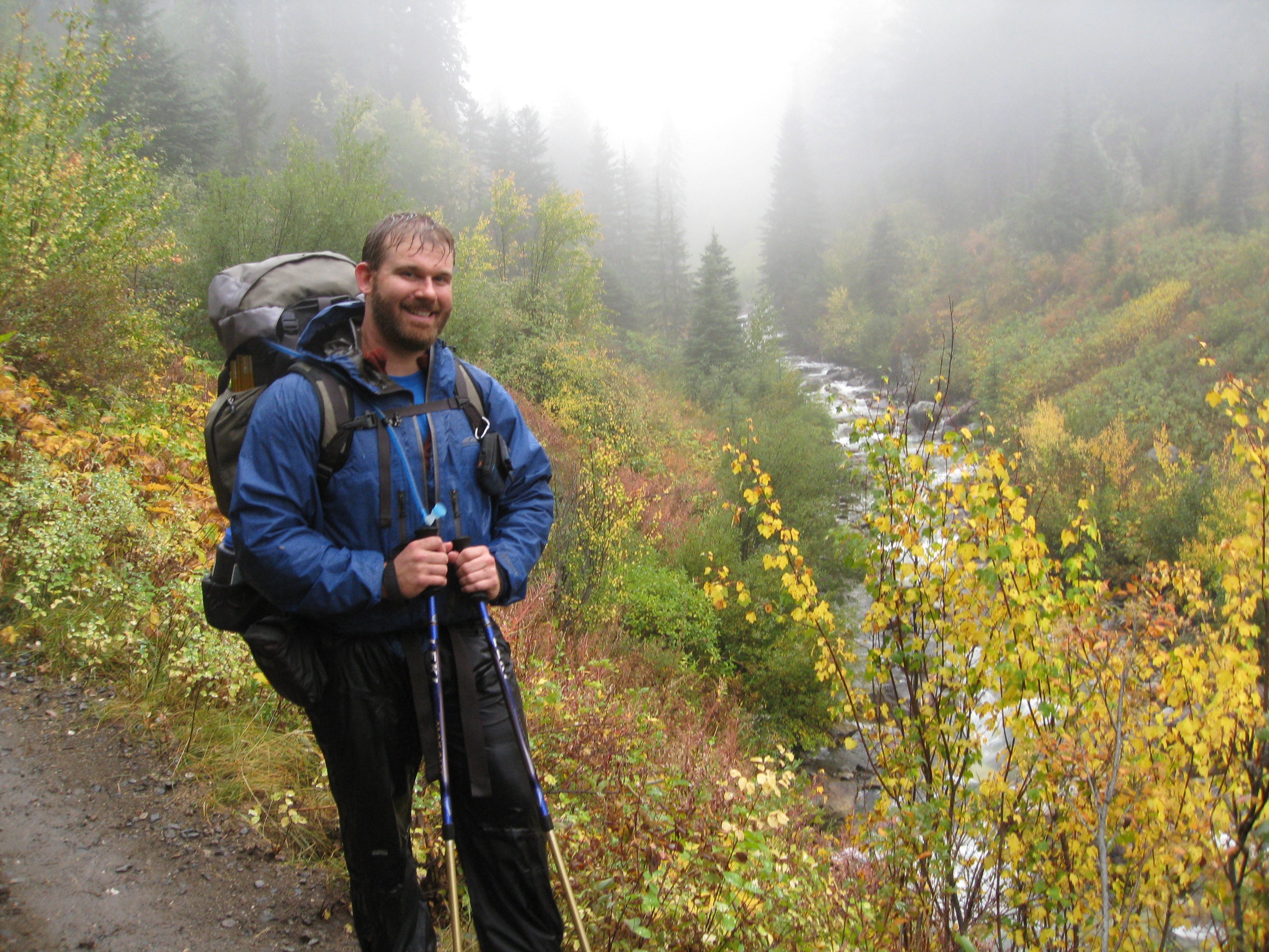
Day 3: The third day was the toughest hike I’ve ever done, hands down. But I had excellent help and encouragement from Smokey, Asterisks, and Tuesday making it through the 17.7 mile march out of the woods. We had intended to only go around 8 miles or so, but the weather was so bad that we decided to press on and make it out versus camp in the miserable rain that had started the night before.
The rain let up long enough for us to break camp in the morning and get to Glacier Lake. The way up to the pass was the only real elevation of the day, taking us up about 1500 feet. From Glacier Pass, we made our way to Moccasin Lake where Ian and I met up with the trailblazers (Steve & Allen) who had intended to climb Eagle Cap. But the fog and the rain were so bad that they scratched that plan and we all decided to make our way out. This is where I learned some of the most important backpacking lessons of my life:
(1) If you get wet, get dry as soon as possible. If you know me you know I sweat. Hiking in the rain is a particular challenge for me, since I’m sweating on the inside and wet on the outside. When it started raining hard, I put my rain gear on over my sweat-wet cloths which kept getting wetter and wetter. Eventually I was so miserable-shivering cold that I had to change out. The lesson here is that I shouldn’t have waited; as soon as I changed I was a much happier hiker.
(2) Eat if you’re hungry. This one’s obvious, but because of the weather and the desire to push through we delayed lunch longer than we should have. As a result, our energy and moral dropped dramatically before lunch. We had set a goal, we were trying to hit it and thus ignored our bodies. Once we got some food in us, the rest of the day was actually a lot of fun even though the weather continued to be crap.
(3) Ditch your pride at the trailhead. I was having a hell of a time on Saturday’s hike towards the end of the day. I was wet, tired, and I had the worst foot pain I’ve ever had while hiking. The first 8 miles weren’t bad, but as I got wetter and traveled farther I was slowing to a shuffle and fighting shooting pain with each step. The guys offered to take some weight off my back but I wouldn’t let them. And I was resisting taking meds. However, once we stopped for lunch and I got dry, reason started to set in and I got over my pride. I popped some ibuprofen, let Steve and Allen take about 10lbs off my back, and Ian lent me his trekking poles for the remaining 10 miles. The combination of the above made the trip out both possible and enjoyable. I still owe those guys a beer for the help.
(4) Being over-prepared can be the same as unprepared. I over-packed by about 5-10lbs. No joke. Having that much extra weight made the trip much harder than it had to be. My pack, fully loaded with water & food, weighed in at 55lbs at the start. Part of the weight was extra food, the rest being miscellaneous this and that which can be trimmed. Add that weight to my bodyweight and I was putting about 280lbs total on my feet. That’s just too much; it’s no wonder my feet were giving me hell. I’m going to fix that for the next trip, for sure.
The Finish Line: We made it out, however, and with plenty of time to spare. We finished the rum/whiskey, made our way to the hotel, ordered pizza and crashed. It was some of the best sleep of my life. The trip was so much fun despite the ‘learning experiences’. As always, it’s the company that makes it fun and this trip was no exception. My hat goes off to Ian for the excellent planning and execution on this hike. I’m looking forward to next year’s trek with the guys.
All of my pictures from the trip are here.
Yes, he did. So did I (my lil tiny one). That's how I got the night shots and the group photos I took. :)
Did Allen bring his tripod? ^_^